Finding the Ocean – Chapter 7
The Bonneville Salt Flats and more bad planning
Posted by joy.the.curious on Oct 28, 2018 in Finding the Ocean, Jacob | 4 comments
On September 1, 2017, I did something a little crazy. (Again.) On a complete and utter whim, I took off on a 4,700 mile road trip to go find the ocean. Just me… and the dog.
Follow along on my healing and soul-inspiring journey below, or start from the beginning…
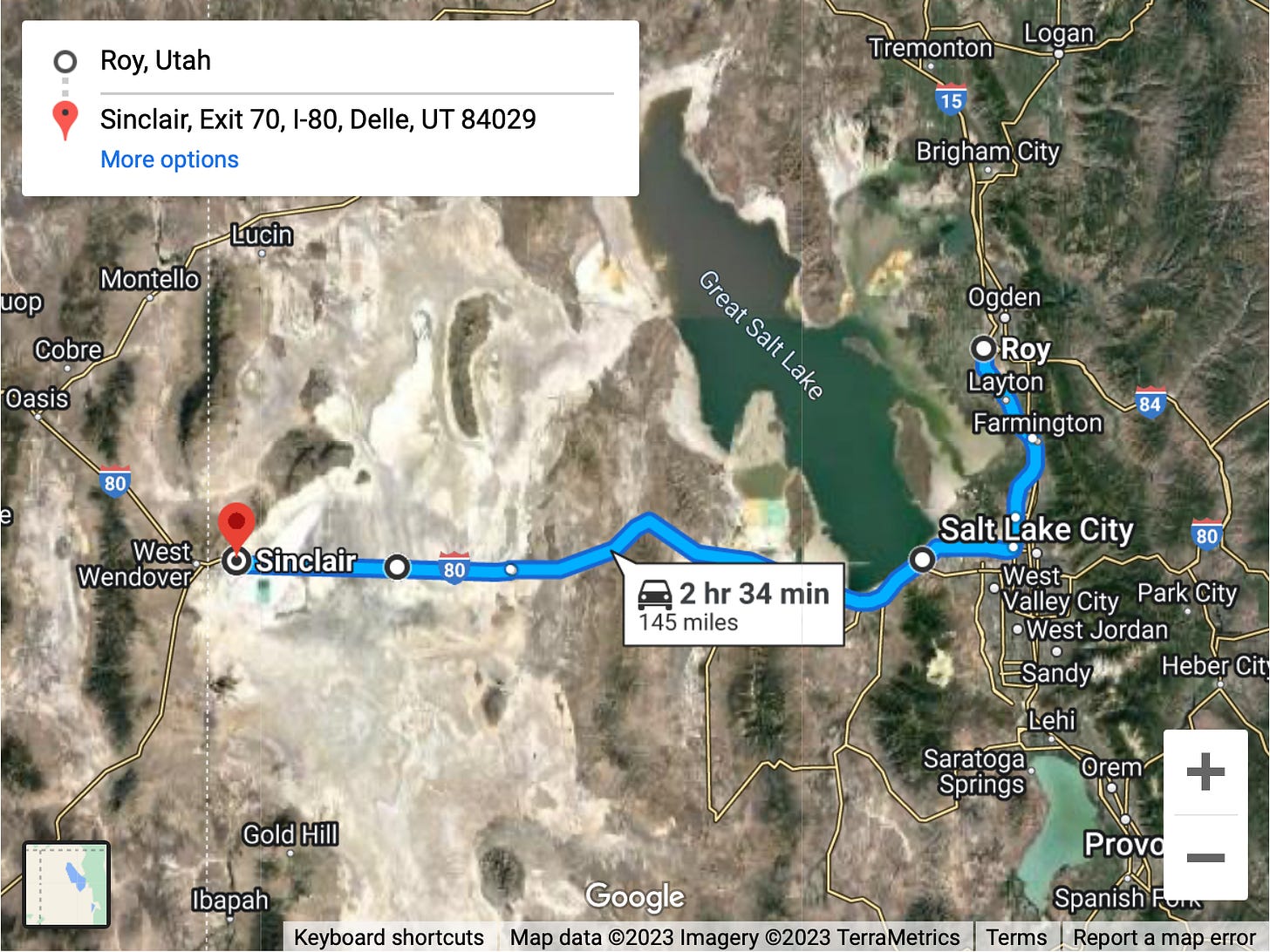
I left Stephanie and Conrad’s house in Roy, Utah around 10:15 AM and started making my way back toward Salt Lake City. As I got closer, I started wondering what this lake actually looked like. Where was it? Would I go past it on my way?
I zoomed out on my car’s GPS screen and noticed that I would indeed be passing along the south end of Salt Lake. Awesome! I couldn’t wait to see it. I wondered if people could swim in Salt Lake. How salty was it? Were there beaches? Could Zoey go for a swim? I had no idea.
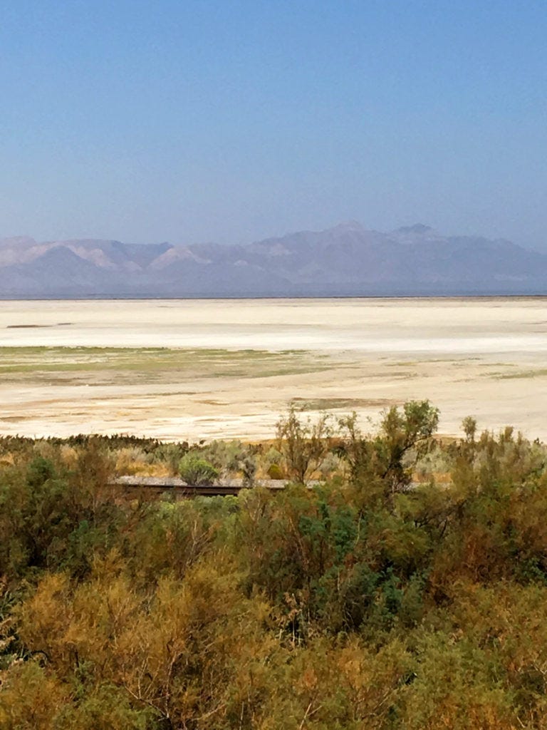
About 45 minutes later, I caught my first glimpse of the Great Salt Lake. There was a barbed wire fence that separated the road from the lake, and I noticed a lone railroad track that cut between the prairie grass and scrub brush that covered the ground for several yards. Beyond that was a long stretch of white. What was that? Salt? If so, where did the salt end and the water begin? Hmm. This isn’t exactly what I’d expected.
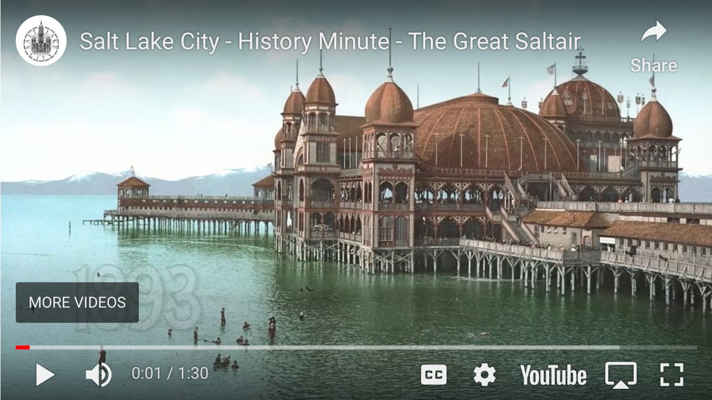
What I didn’t realize at the time, is that the place I was staring at was very near to the original location of “Saltair – the Coney Island of the West.” I learned this when I noticed a marker on Google Maps that said “Historic Saltair Location” while writing this article and decided to click on it. Next, I Googled “Saltair” and found this great little video that explains a bit about the history of what I was looking at. So, in answer to my own question, yes, apparently people could, and did, swim in the Great Salt Lake.
Interesting.
I continued driving and happened to notice the time. It was 11:09 AM. In two minutes, it would be 11:11, and in that moment, I immediately thought of Jared and the Wetterlings. When I first met Jared in 2013, he always used to point out when it was 11:11 and say, “Make a wish!” I never knew what he was talking about at the time, but always thought it was sweet. Of course, after Jacob was found and the #11forJacob movement took off, 11:11 took on even more meaning for me. Now, I marvel at how often I notice when the clock says 11:11, and every time, I make a wish, think of Jacob, and say a little prayer.
Now, in this moment, I began to feel very alone on this long stretch of road ahead of me. When I’d taken off on this impulsive road trip, I hadn’t told a soul what I was doing except my husband. I didn’t want to explain anything to anybody, and I didn’t want anyone to worry about me. I just wanted to get away and not think for a while. I especially didn’t want to think about what had taken place on this holiday weekend exactly one year earlier. But now, I felt really disconnected and lonely. I wondered how Jared and the Wetterlings were doing. Even though it was all painful to remember, this incredible journey was something we all went through together and we would be forever connected because of it. And in that moment, on 11:09 AM on September 3rd, 2017, I realized how much I missed them.
I pulled over to the side of the road and took this picture at exactly 11:11 AM. I sent it with the caption “11:11” to Jared, Patty, and Jerry.
I explained that Zoey and I were on a road trip and headed to the ocean. I told them I’d made it to Salt Lake so far, and when I happened to notice it was 11:11 AM, I pulled over, took a photo, and wanted to let them all know I was thinking of them.
Jared texted back to let me know that he and his girlfriend were spending the day together with their kids at Sibley State Park, not far from my home in New London. Patty and Jerry were also spending the weekend with family, and I was so happy and relieved to hear from all of them.
Next, Jared replied with the following text:
“I learned how to drive a semi-truck at age 20 on the Utah flats. Take care and safe travels everyone.”
Hmm. I never knew he’d learned how to drive a semi in Utah. I wondered what he meant by the “Utah flats.” Was I on the Utah flats? I had no idea. I got back in the car, feeling much more at peace, and continued on my way.
Oh my.
It is hard to explain the weirdness of the next 37 miles.
Again, I must stress that even though the spontaneity of my trip was, in part, the very glory of it, my incredible lack of a plan or any knowledge of where I was at any given moment in time was certainly a detriment. One year later, as I relive this road trip on Google and Google Maps, I am learning so much about what I saw (or should have seen) along the way.
Apparently, the stretch I was just entering is known as “The Bonneville Salt Flats.” Having never heard of such a thing, I can only say that it felt like driving across a frozen lake in Minnesota in mid-January. The flat ground looked like it was covered in snow for as far as the eye could see. Here’s a quick snippet from Wikipedia that explains all this a little better:
The Bonneville Salt Flats is a densely packed salt pan in Tooele County in northwestern Utah. The area is a remnant of the PleistoceneLake Bonneville and is the largest of many salt flats located west of the Great Salt Lake. The property is public land managed by the Bureau of Land Management and is known for land speed records at the “Bonneville Speedway“. Access to the flats is open to the public.
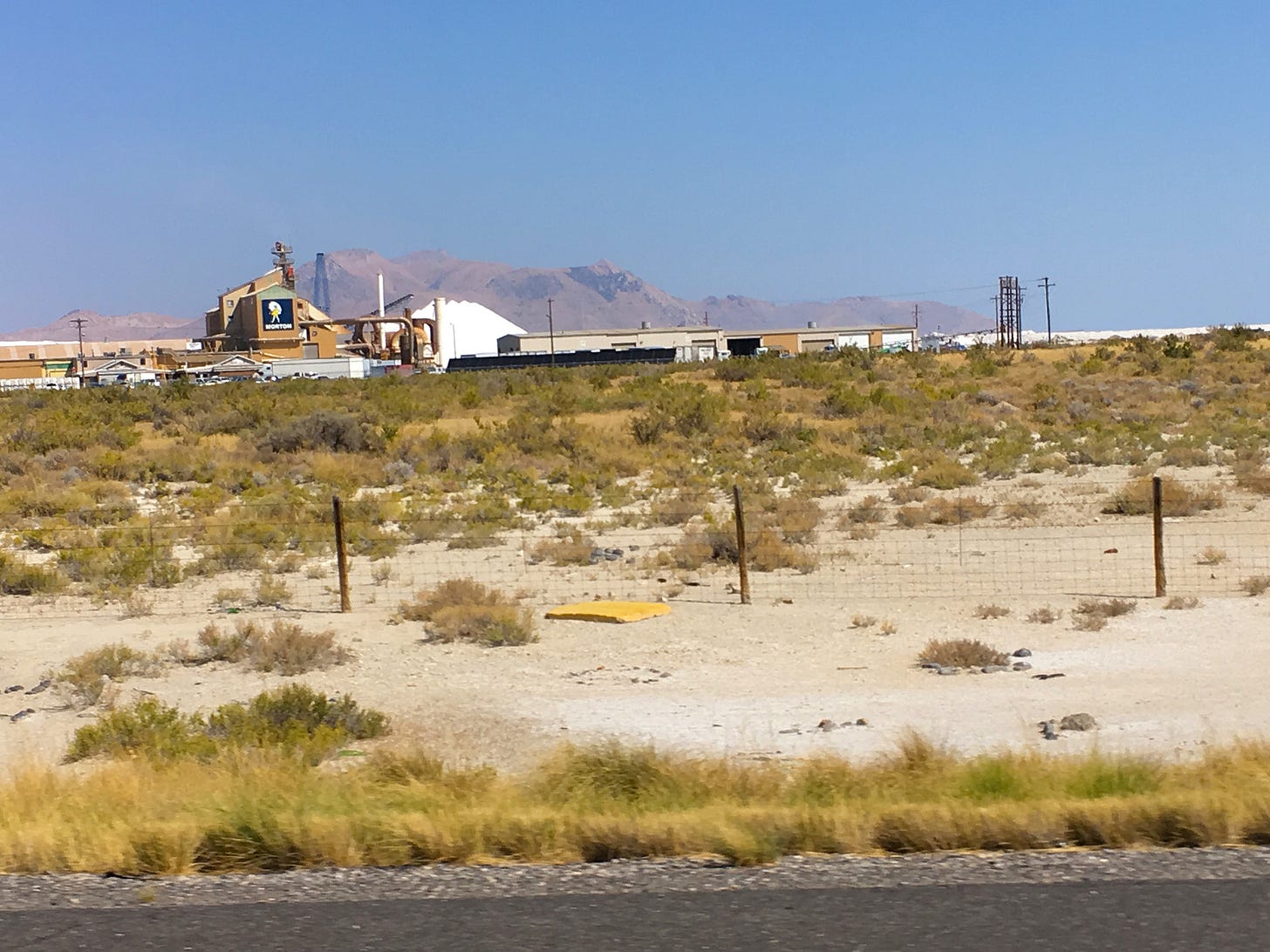
Of course, I knew nothing about any of this as I continued to drive across this hot, white, not-frozen, not-lake. After a bit, I passed a big building with a logo I instantly recognized… Morton Salt. Huh. In all my days, I guess I never wondered nor realized where Morton got its salt. And now, there it was… a big white mountain of it… piled directly behind that little girl with her white umbrella and yellow dress. I took this quick picture as I flew past at 80 miles per hour (because that, my friends, is the speed limit on the Bonneville Salt Flats).
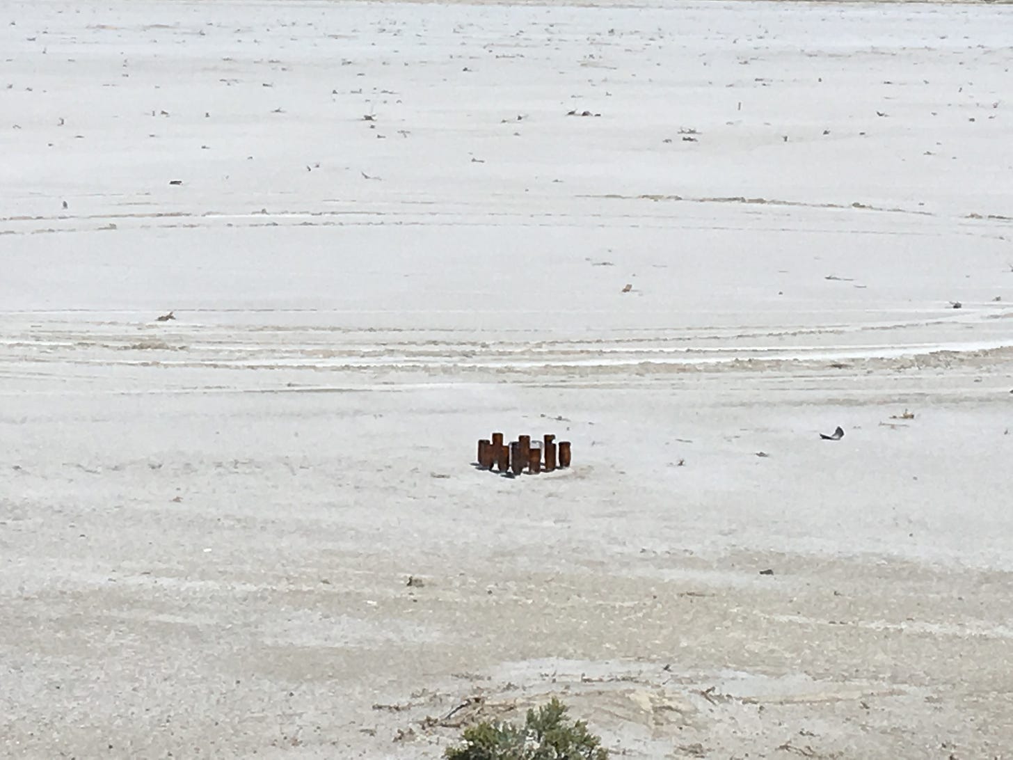
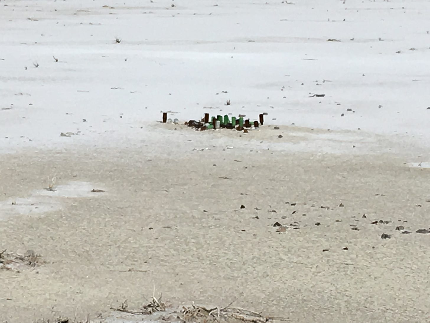
As I drove along, I kept noticing small groups of things… pipes?… sticking out of the white ground. What could that be? I passed these groups of pipes every so often, and finally I couldn’t take it anymore. I had to stop and see what these things were. Why were there pipes sticking out of the ground?
I pulled over again and walked over to one of the pipe groupings. Turns out, they were not pipes at all, but beer bottles turned upside down and stuck into the salty ground. What in the world was that all about? I took a picture and got back in the car.
Now that I knew what these things were, I kept spotting them more and more often. Seriously, what in the world? I could come up with no logical explanation, and made a mental note to Google it once I got home.
A year later, I don’t have much of an answer. Apparently people sometimes write their names or messages using empty beer bottles, but that’s obviously not the case here. Maybe someone stopped at each of the places where there were bottles strewn about and decided to poke them into the ground to create a series of cheap and quirky art installations. Hmm. Interesting. Again.
And, speaking of quirky art installations, holy crap. How do you explain this? I could see this odd monstrosity coming up on my right for miles, and once I finally got close enough to get a good look at it, I still had no idea what it was. I was sure it must serve some kind of purpose, like a satellite antenna, cell phone tower, or radio transmitter, but no. It’s art… in the middle of absolutely nowhere.
“The Tree of Utah” (aka “The Tree of Life”) was designed and built by Swedish sculptor, Karl Momen in the 1980s. The pieces lying on the ground (which I assumed were broken pieces of cement balls that had crashed to the ground, thus resulting in the installation of a safety fence) are actually intentional and supposed to represent leaves that have fallen from the tree. Oh, and ironically, the inscription on the trunk of the tree is from the song/poem “Ode to Joy.”
You can read more about it here.
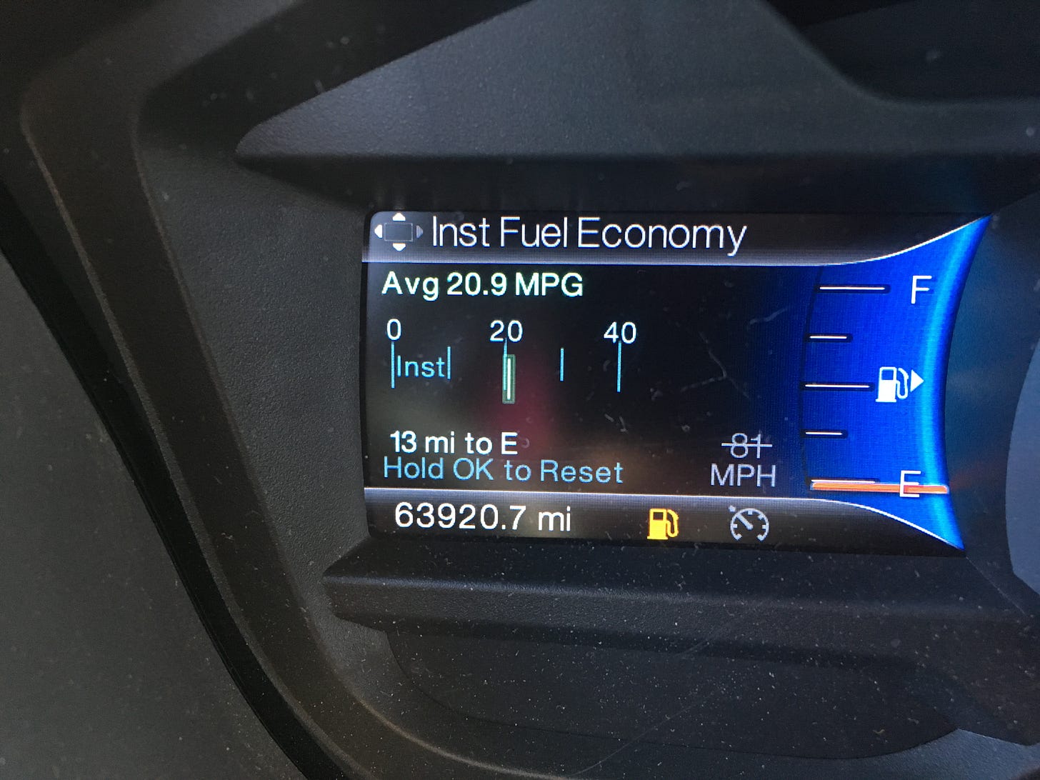
By the time I reached “The Tree of Utah,” I had been driving for over three hours and just happened to glance at my gas gauge. It said I had 35 miles to go until empty. Hmm. It occurred to me that I hadn’t seen a gas station since I’d started my journey across this not-frozen, not-lake almost an hour and a half ago. Oh well, no worries. I was sure I’d hit the end of it soon enough.
I clipped along at 80-85 miles an hour with cars passing me like I was standing still. Another half hour went by and there was still no end to the not-frozen, not-lake. I was starting to panic a little bit. What if I ran out of gas? It was almost 90 degrees outside. There was no way I could walk, nor could I stay in a hot sweltering car with no air conditioning. Maybe I could get a ride from someone to the nearest gas station, but what about Zoey? Would they take her, too? I couldn’t leave her alone in the car in this hot salty desert.
Another fifteen minutes went by. I glanced at the gas gauge… 15 miles until empty. OMG, this was really happening. I was going to run out of gas in the middle of a desert. This is the stuff that happens in horror movies and you don’t even feel sorry for those stupid people because they deserve whatever happens to them because they should have planned better.
By the grace of God and my own dumb luck, I reached the Sinclair Truck Stop just outside of Wendover with only 13 miles left on the gas gauge. Phew! Lesson learned. After taking Zoey for a quick walk on the salty ground, I chalked it all up to a learning experience and vowed to be a little more pre-planny and logical than free-spirited and curious.
Next time
A long stretch of nothing and a creepy white van
4 Comments
sue | October 29, 2018 at 8:07 pm
I love this story!!
Bostonian | October 31, 2018 at 9:48 am
I am thoroughly enjoying your adventure to the ocean!
Amy | November 5, 2018 at 5:02 pm
This has been so interesting to read!
Kathy a/k/a Mom | November 14, 2018 at 12:42 pm
Good thing I didn’t know what you were doing “You know how I worry”. Looking forward to the next episode. xoxo Mom
![[ j o y . t h e . c u r i o u s ]](https://substackcdn.com/image/fetch/$s_!UzSv!,w_40,h_40,c_fill,f_auto,q_auto:good,fl_progressive:steep/https%3A%2F%2Fsubstack-post-media.s3.amazonaws.com%2Fpublic%2Fimages%2F9a3fc6e9-2c7b-49f3-a947-5510d6ac2bd3_500x500.png)
![[ j o y . t h e . c u r i o u s ]](https://substackcdn.com/image/fetch/$s_!RoQy!,e_trim:10:white/e_trim:10:transparent/h_72,c_limit,f_auto,q_auto:good,fl_progressive:steep/https%3A%2F%2Fsubstack-post-media.s3.amazonaws.com%2Fpublic%2Fimages%2Ff10a4cb8-9c26-4c77-a86d-fd0df8c2f58f_1344x256.png)


